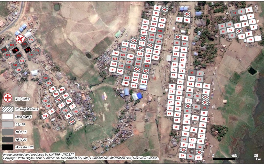
In June 2012 inter-communal violence broke out in Rakhine state, Western Myanmar between the Buddhist Rakhine community and the Muslim Rohingya community, the largest stateless population in the world[1]. This violence displaced approximately 147,000 people into...
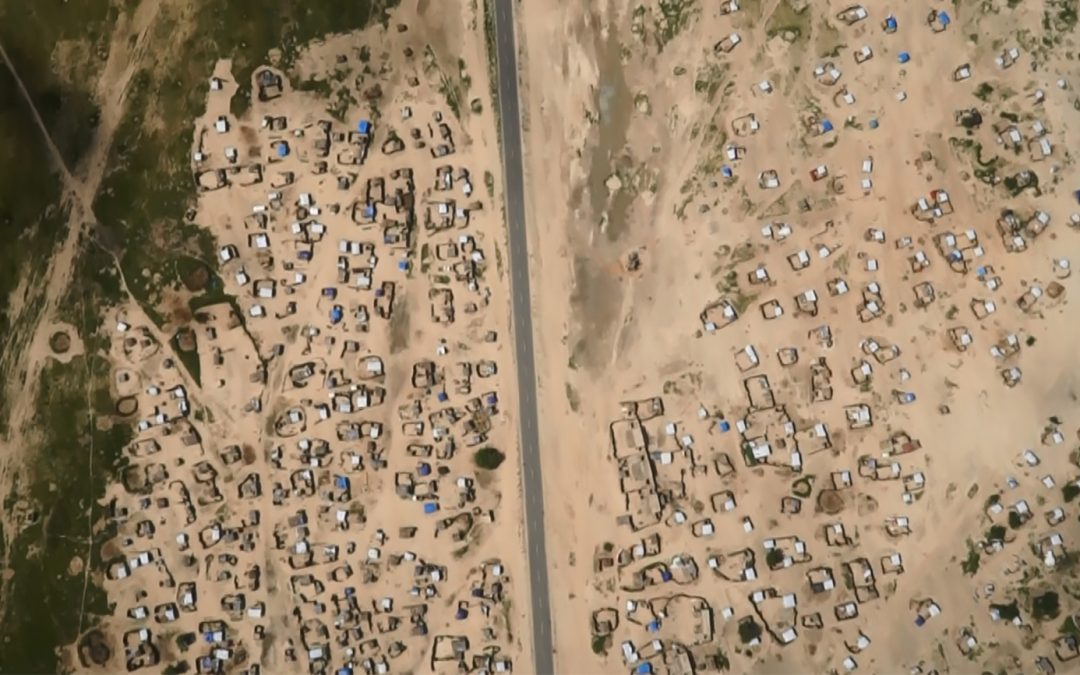
Following massive population displacements from Nigeria and within Niger in 2015 and 2016 the UNHCR operation and partners in Niger were faced with a significant mapping challenge. At the end of July 2016, there were reportedly up to 300,000 people displaced within...
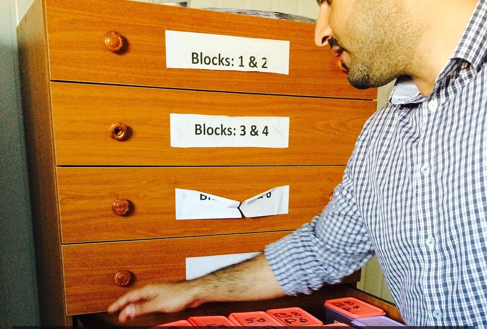
Yahya Hassune, doesn’t take no for an answer, quite fortunately for UNHCR. About two years ago, Hassune was working on his first day as Associate Field Officer in Azraq, a new camp located in central-eastern Jordan that currently hosts about 26,000 Syrian refugees...