Lesson plans for ages 15-18 in History: Population Displacement in the Commonwealth of Independent States
Lesson plans for ages 15-18 in History: Population Displacement in the Commonwealth of Independent States
-
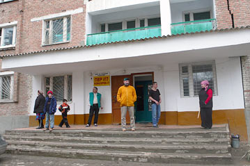
Displaced Chechens outside the temporary accommodation centre where they live in Grozny. Some 3,000 displaced families could be in line for new housing under a government plan.
LESSON 1: Where do people go when they are forced to move?
Preparation
Run off a class set of the Activity Sheet: The Commonwealth of Independent States (CIS).
Teacher's Resource Sheet 1: "Displaced people in the former Soviet states", has been provided as background information.
Procedure
Looking at the map on the Activity Sheet: The Commonwealth of Independent States (CIS), allow the students a few minutes to familiarise themselves with the names of the CIS countries. A number of the CIS countries end with "-stan". Most likely the students would have heard of some of them, but only vaguely know that these countries are somewhere in the former USSR, in Central Asia, in the Caucasus...
Two principal areas of the CIS that have been troubled with armed conflict, and have experienced the resulting refugee movements, are the Caucasus and Central Asia. In this lesson, the students should draw arrows on the map on the Activity Sheet to indicate the flow of population displacements in the Caucasus region:
- an arrow from Abkhazia to Russia and another arrow from Abkhazia to Georgia
- an arrow from Georgia to Abkhazia
- an arrow from South Ossetia to Georgia, a second arrow to North Ossetia, a third arrow that crosses Georgia to Abkhazia, and a fourth arrow to Russia
- an arrow from North Ossetia to Ingushetia
- an arrow from Chechnya to Ingushetia, a second arrow to North Ossetia and a third arrow to Daghestan
- an arrow from Armenia to Azerbaijan
- an arrow from Azerbaijan to Armenia
- an arrow from Nagorno-Karabakh to Azerbaijan and a second arrow that crosses Azerbaijan to Armenia.
Students will probably ask why there is a two way traffic of people between some of the countries, as in the case of Georgia and Abkhazia. The next lesson will explain why.
Population displacements in Central Asia can be shown as:
- an arrow from Tajikistan to Afghanistan
- an arrow from Tajikistan to Kyrgyzstan
- an arrow from Tajikistan to Turkmenistan
- an arrow from Tajikistan to Russian Federation
- an arrow from Tajikistan to Ukraine
- an arrow from Tajikistan to Uzbekistan
- an arrow from Tajikistan to Belarus
- an arrow from Uzbekistan to Azerbaijan
- an arrow from Uzbekistan to Russian Federation
- an arrow from the Russian Federation (Chechyna) to Kazakstan
- an arrow from Afghanistan (not a CIS country, but part of the Central Asia region) to Uzbekistan
By now, the students' maps probably look a mess, with arrows everywhere. It is to be hoped that this exercise has conveyed to the students the fact that around 9 million people had been on the move, fleeing violent conflict and ethnic strife. In the next lesson, the students will read about reasons that underlie the ethnic strife.
Related publications